Different Technology is Applied to the Planning Process
This is how different technology can be used in all stages of planning
Region of Peterborough
In the Town of Cavan Monaghan
Concession 10 Lot 6
Brown Line and Airport Road
AnnaMKuleszaConsulting
Anna M Kulesza
2019
In the Town of Cavan Monaghan
Concession 10 Lot 6
Brown Line and Airport Road
AnnaMKuleszaConsulting
Anna M Kulesza
2019
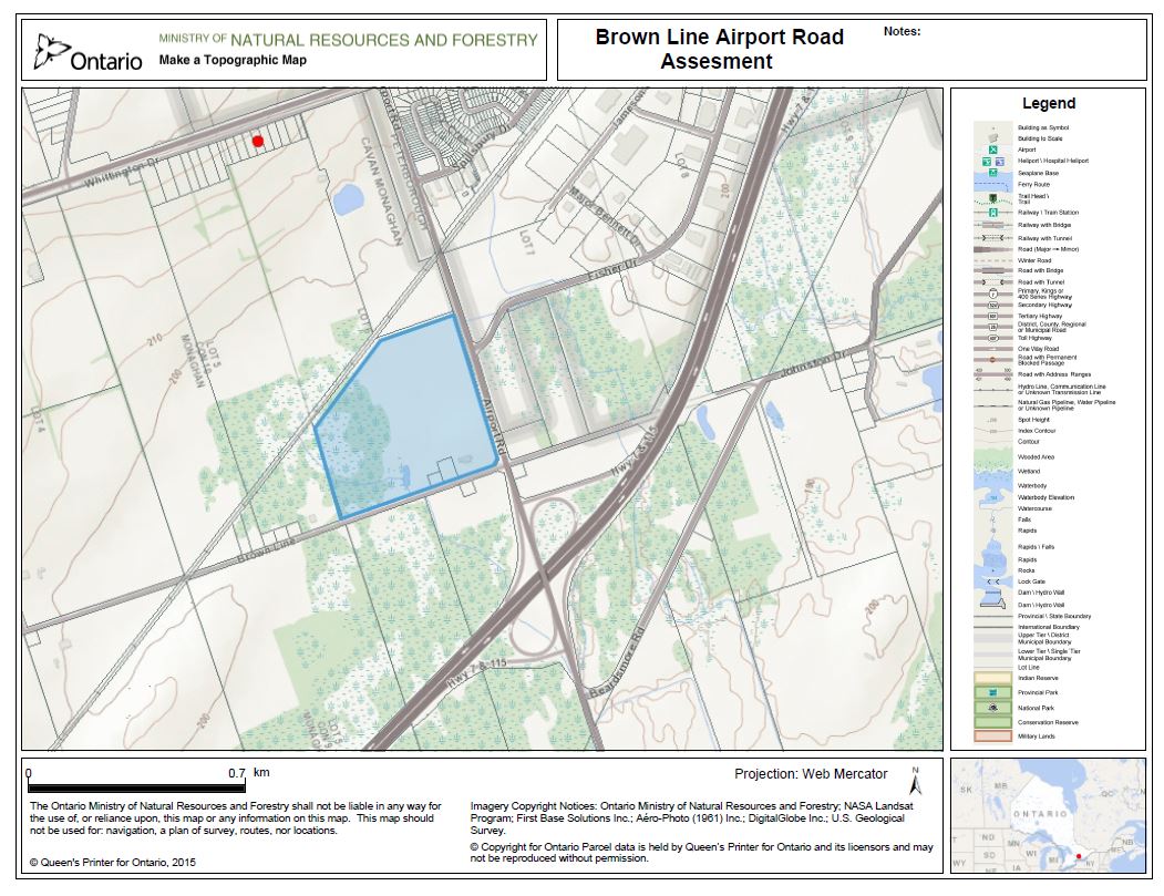
Topographic BasemapFree open software - Government of Canada
This map provides a starting framework for the proposed development. This topographic map was obtained by open source data through the Government of Canada. The map shows a railroad network, a wetland, and two properties within the blue polygon of interest. |
|
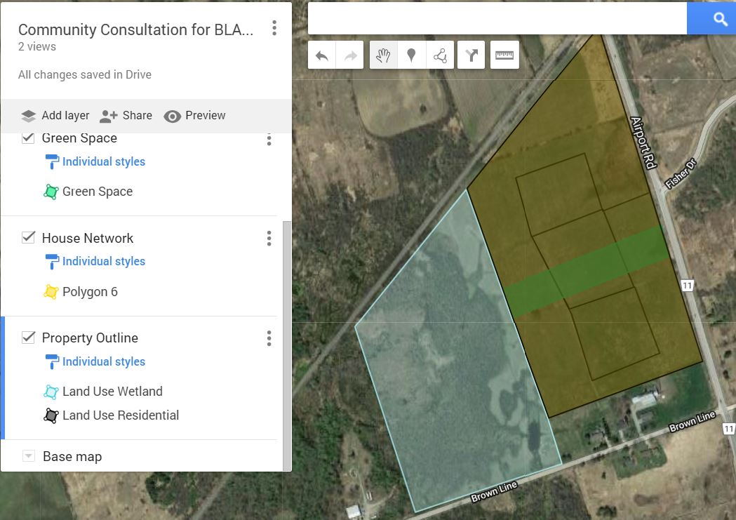
Community ConsultationFree open software - Google
An important element in planning. Using free open software, we are able to gather community members thoughts by allowing them to provide what they envision to us. We provided a workshop for the community members to create their own land use vision of BLAPR] Here is an example of a community member seeing the proposed development. https://www.google.com/maps/d/u/0/viewer?mid=1Jsv4DPtwQpH9ZaCEdhB0fvNvBMxiDTFV&ll=44.25305444168615%2C-78.36831738506078&z=15 |
|
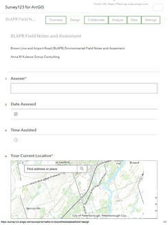
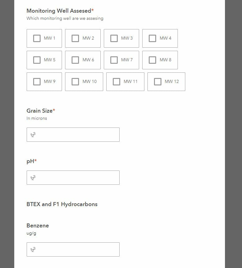
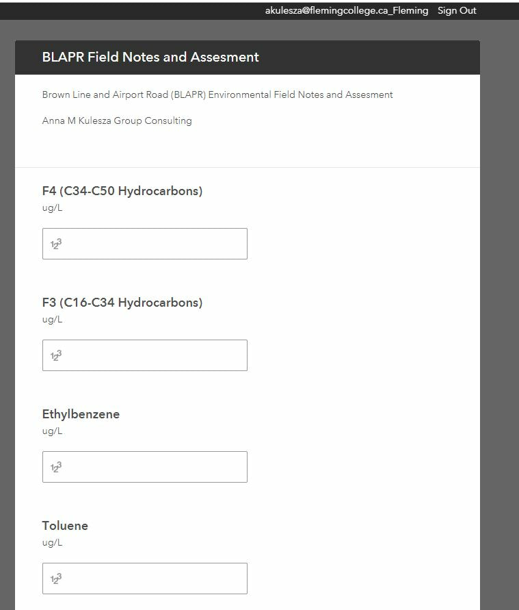
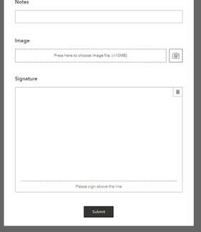
Environmental Assessment SurveyESRI Survey 123
ESRI provides a suit of software that can bring together different sources. Our environmental technician team takes an in house created survey to monitor soil and ground water samples at different stations at different times which are geotagged. It is accessible offline, and on mobile devices which is automatically stored into a cloud database to be analyzed by the technicians immediately . https://survey123.arcgis.com/share/3e7eafcb141042499f4e0adabad505a7 |
|
|
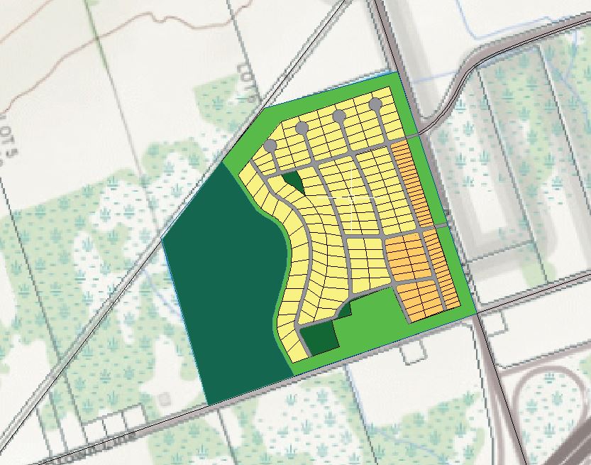
Proposed SubdivisionAuto Desk
Using Autodesk, a subdivision was built 190 new homes for this area Yellow is low density single dwelling Orange is medium density town homes Community park and parkette available |
|
Water Infrastructure- Coming SoonESRI Suit
www.esri.com/en-us/industries/water/segments/water-utilities Water infrastructure network to be created through ESRI inspiration |
